Get in touch
555-555-5555
mymail@mailservice.com
the logo for hometrack real estate marketing

Shorten your sales cycle and sell listings faster.

Get noticed with the power of aerial drone technology! Showcase the exceptional exterior features of your real estate listing with sweeping views and breathtaking perspectives. Ideal for expansive land or water-oriented properties, aerial drone photography provides potential buyers with a unique, bird's-eye view that sets your listing apart. Don't miss out on this opportunity to stand out in the real estate market. Contact Hometrack today to upgrade your listing with aerial drone photography.

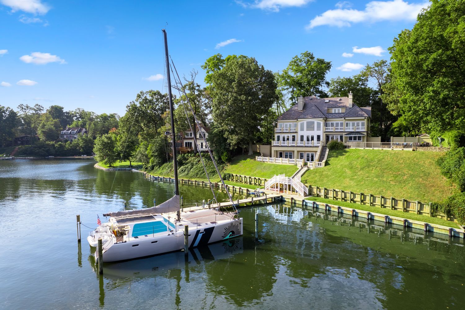
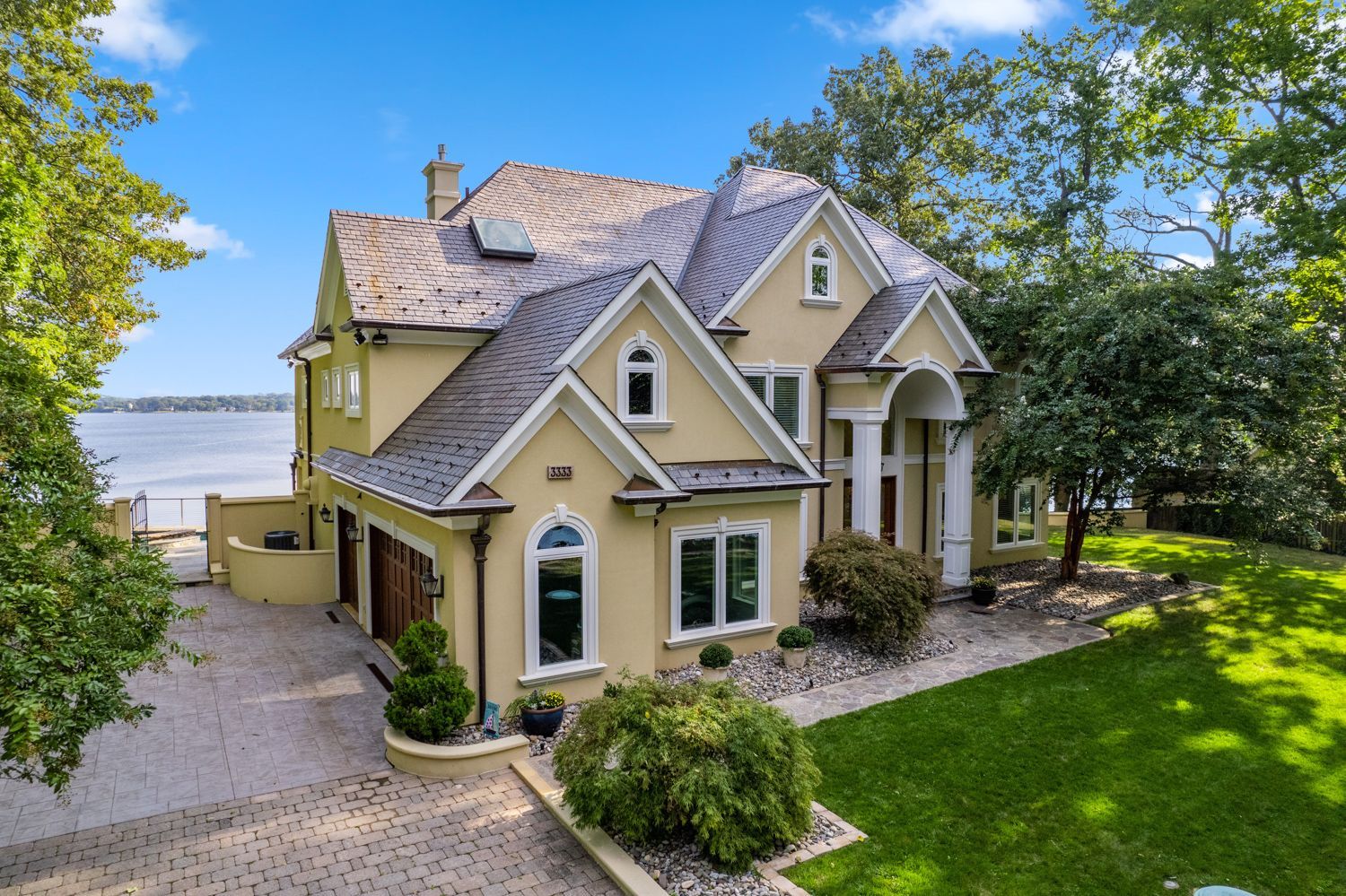
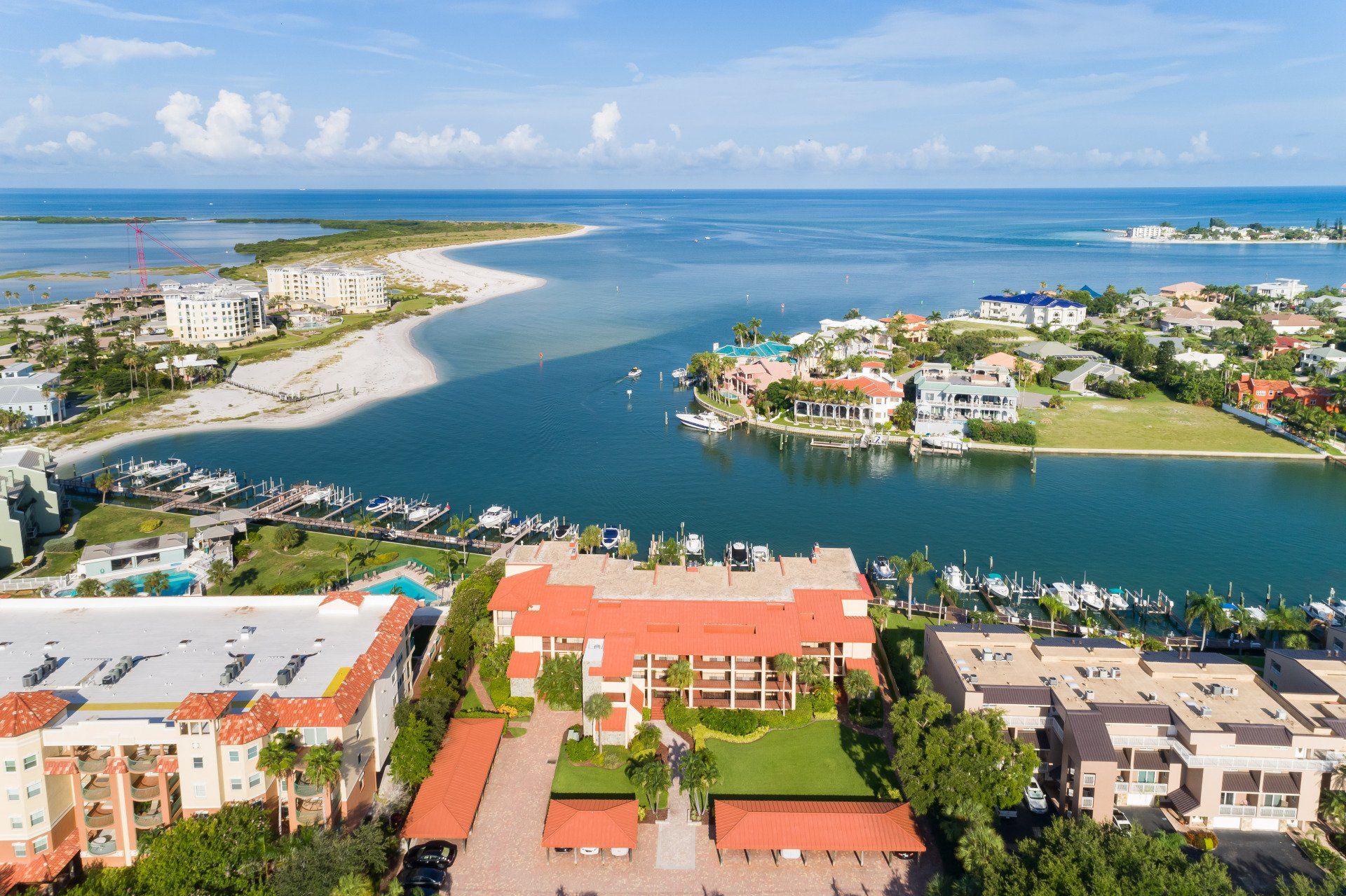
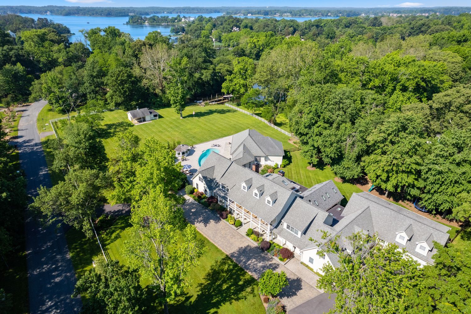
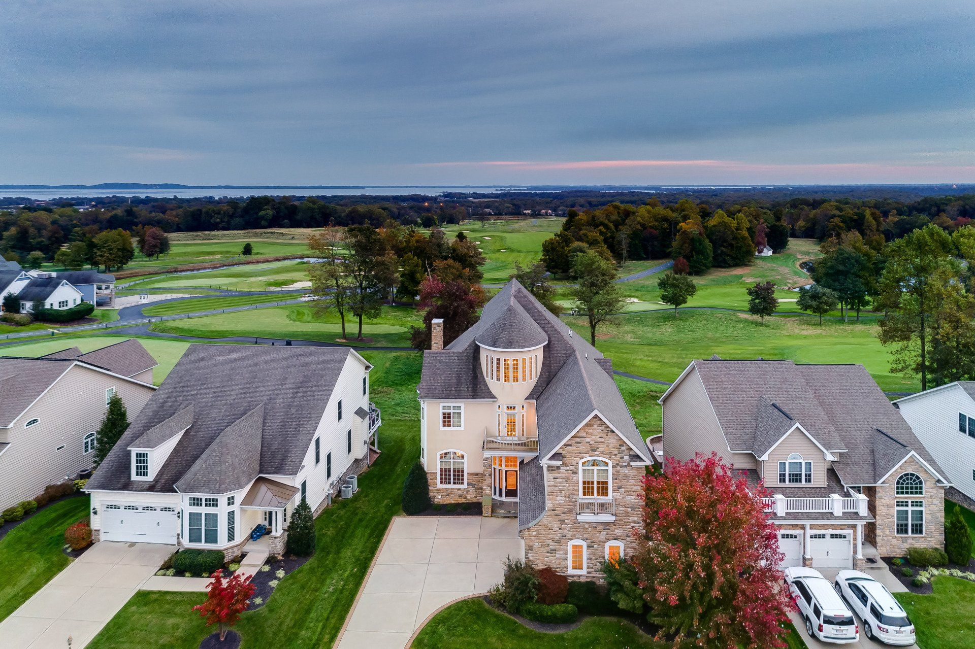
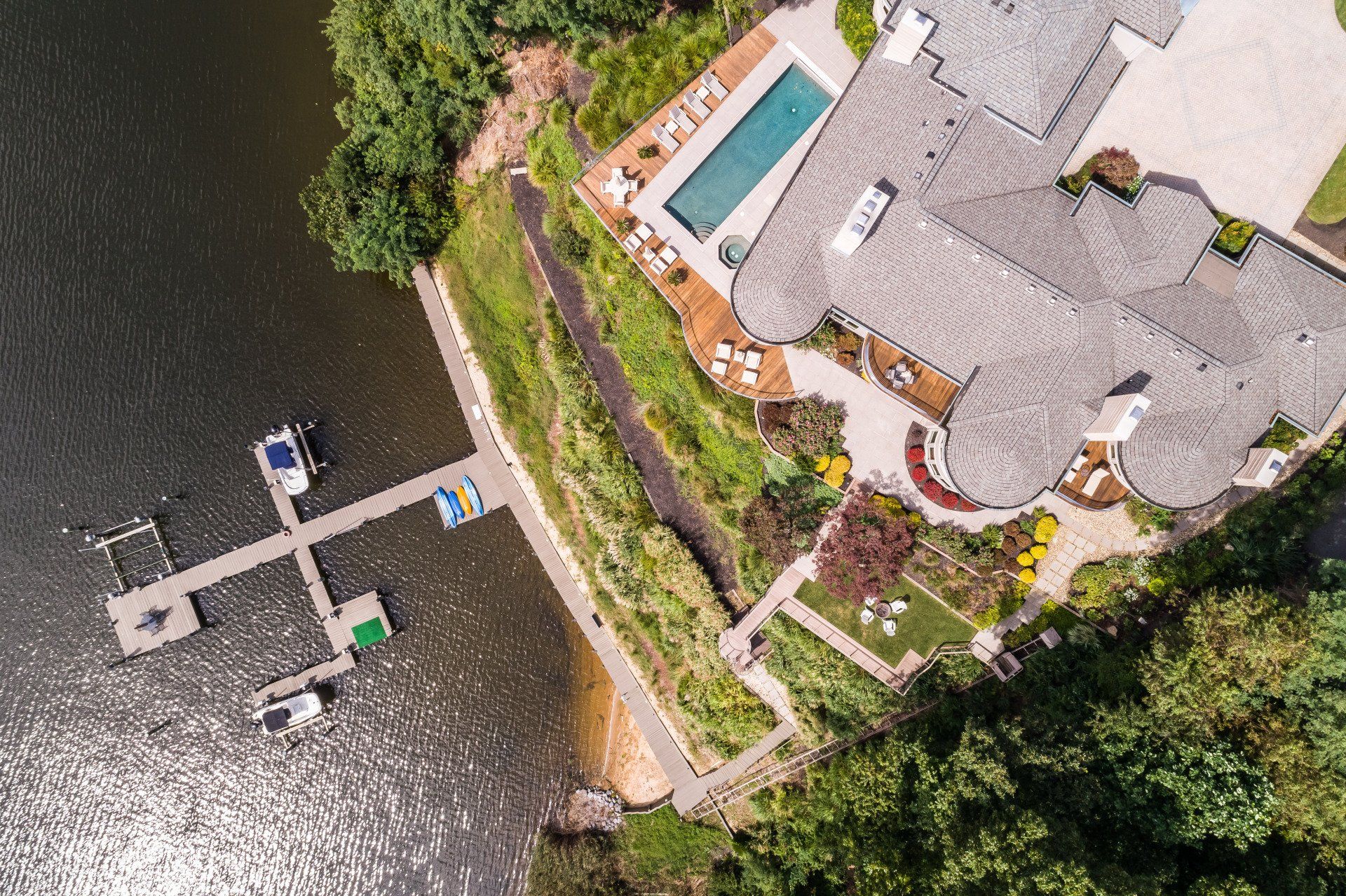
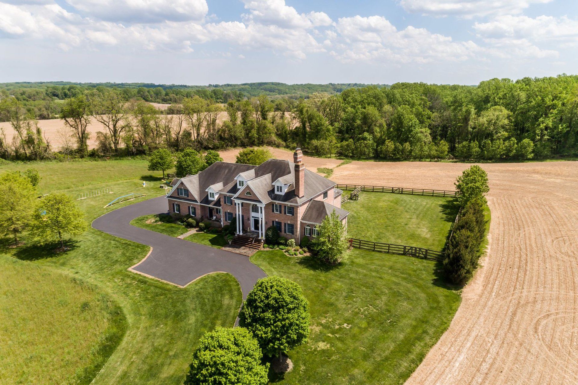
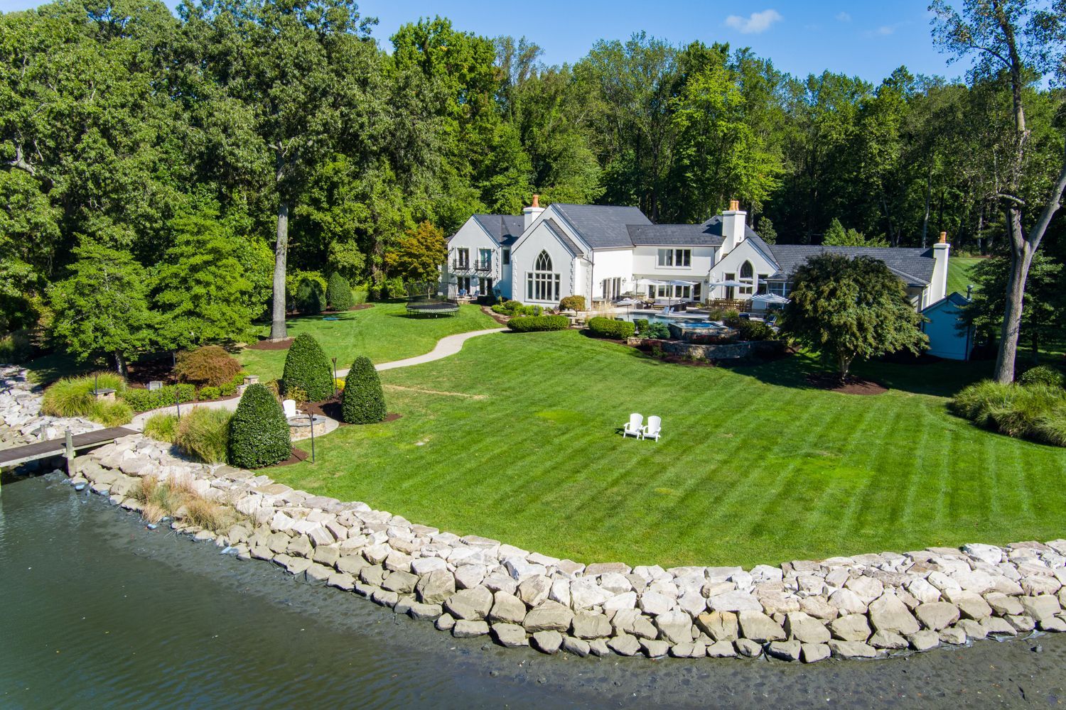
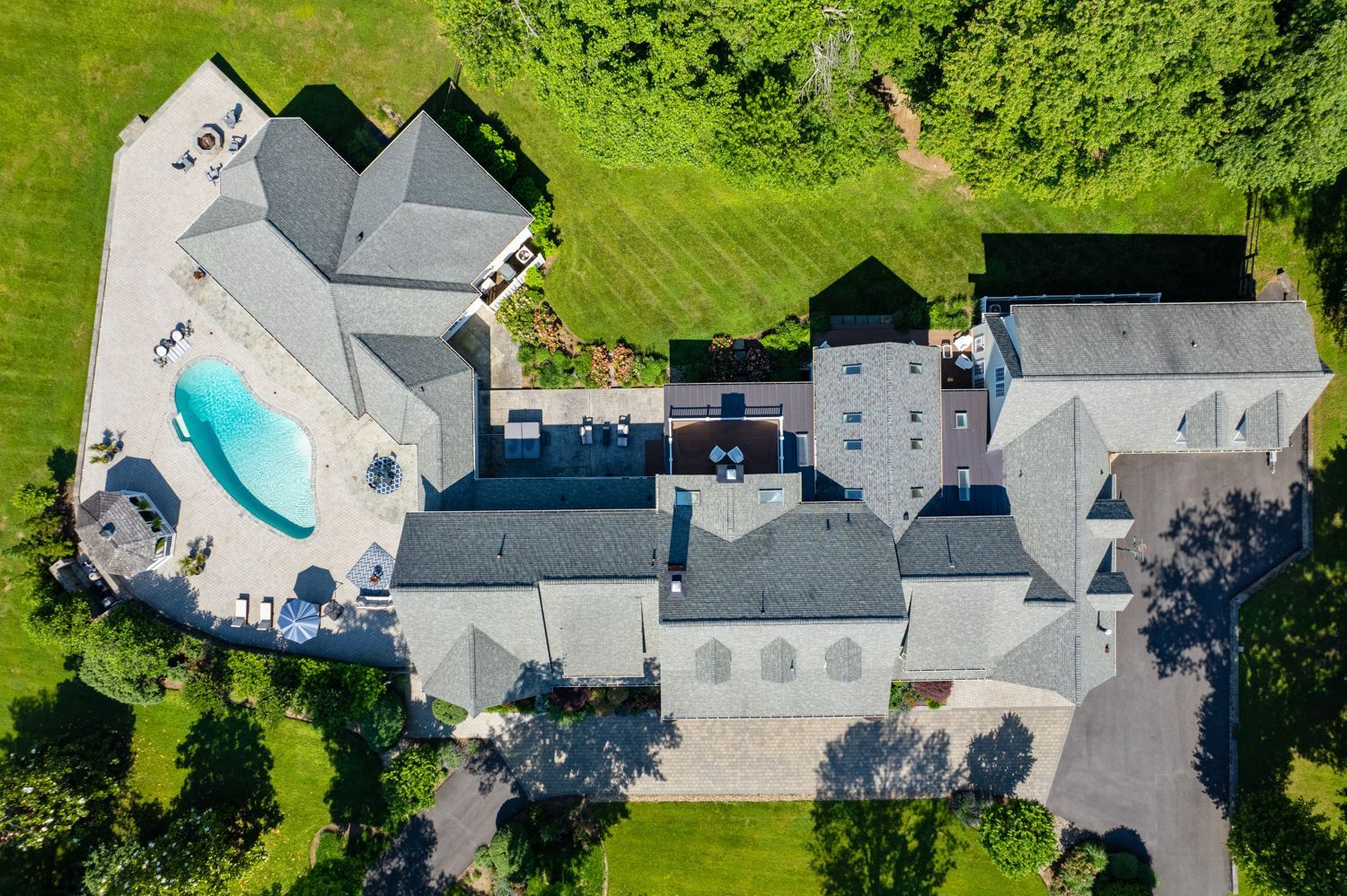
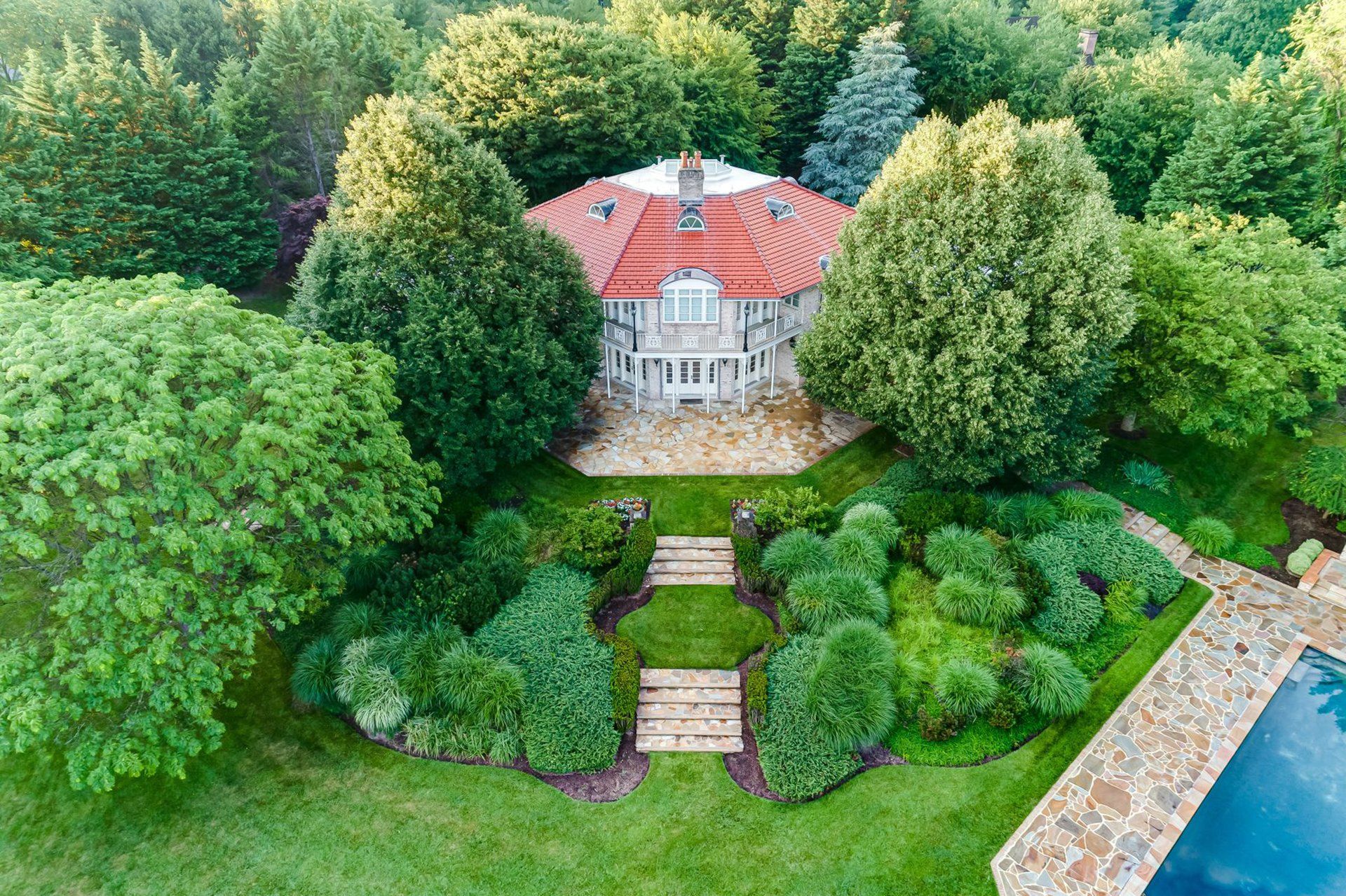
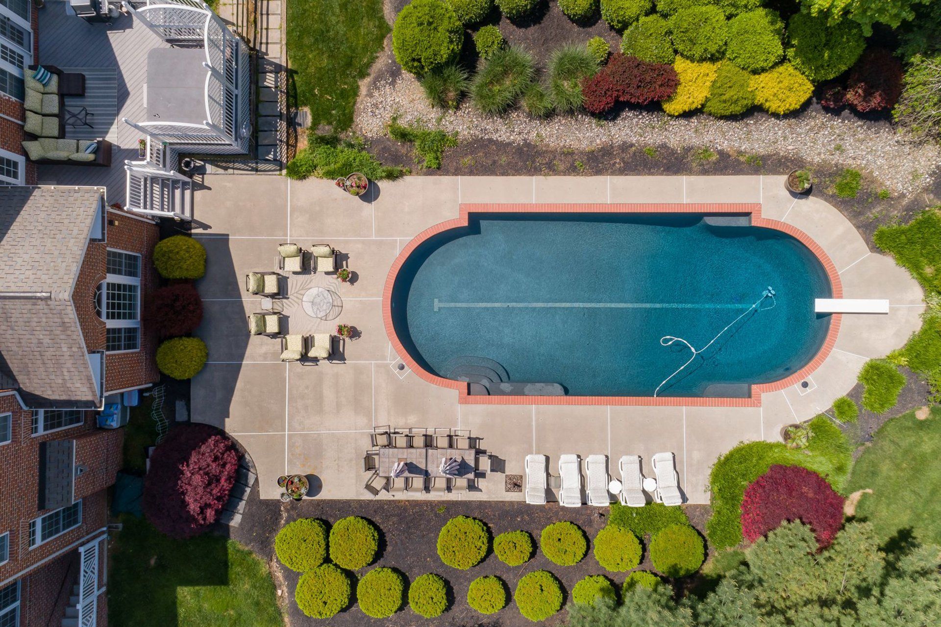
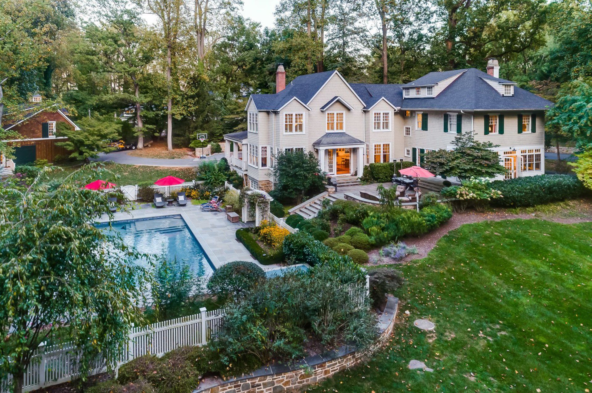
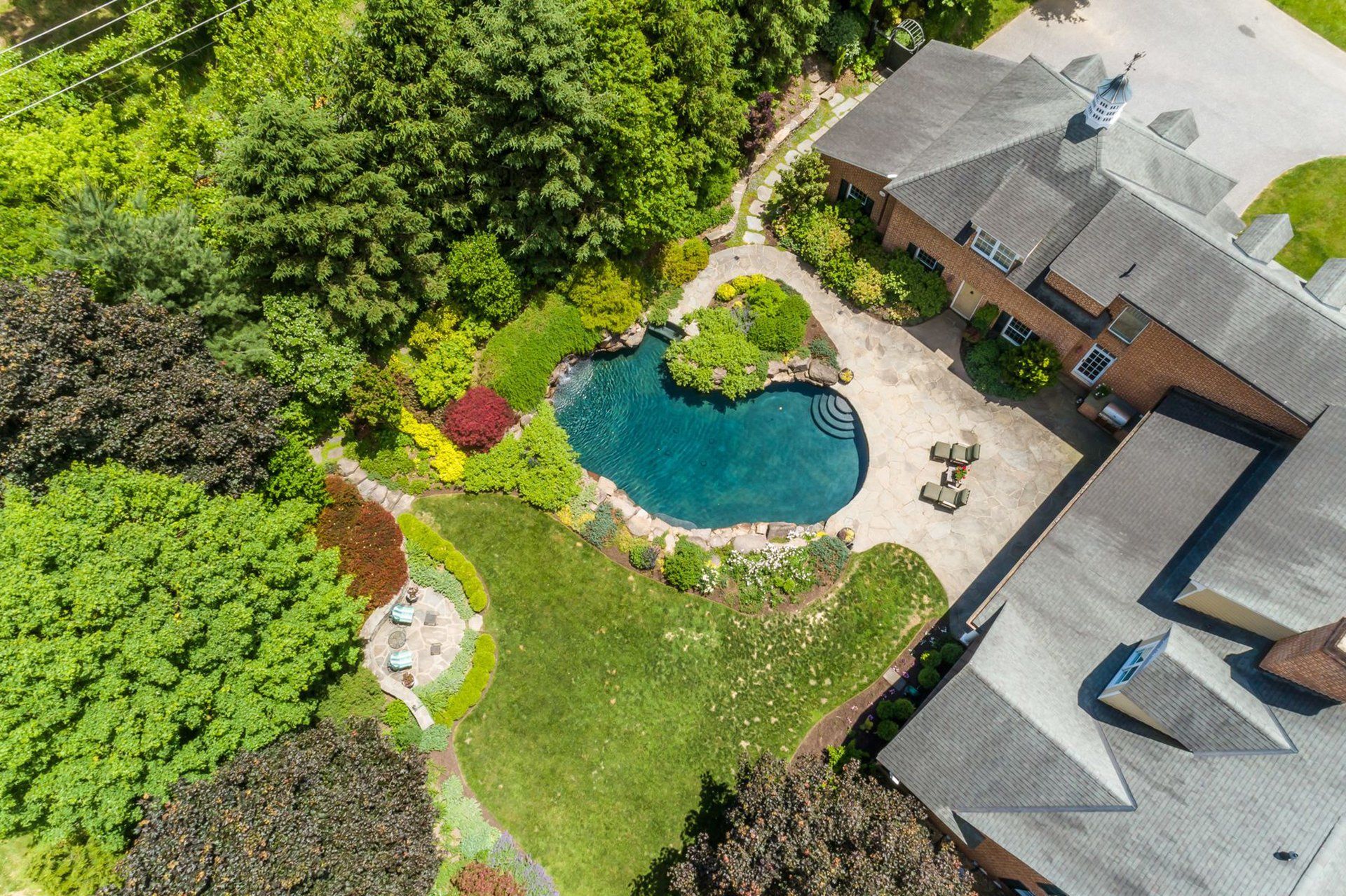
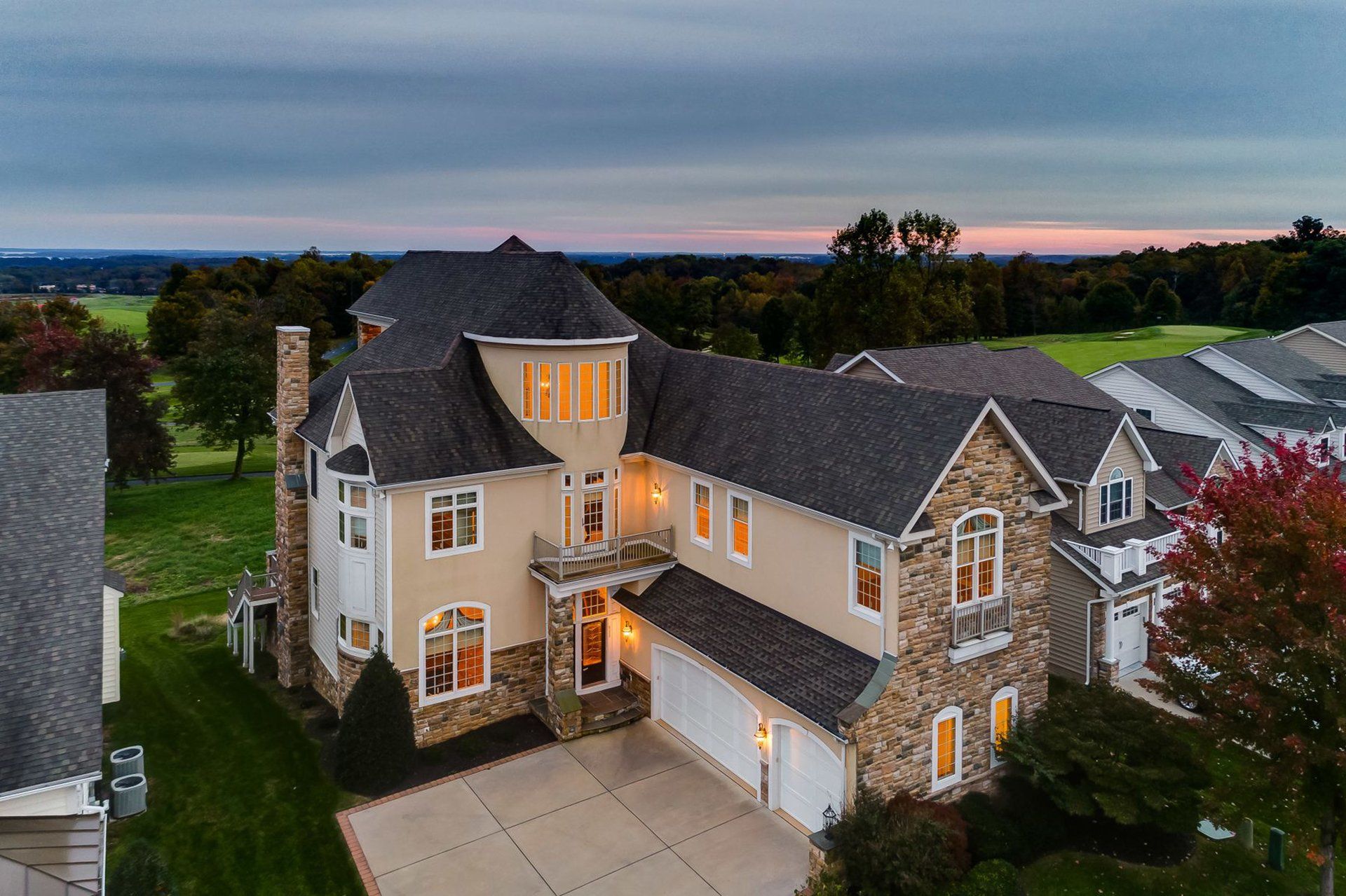
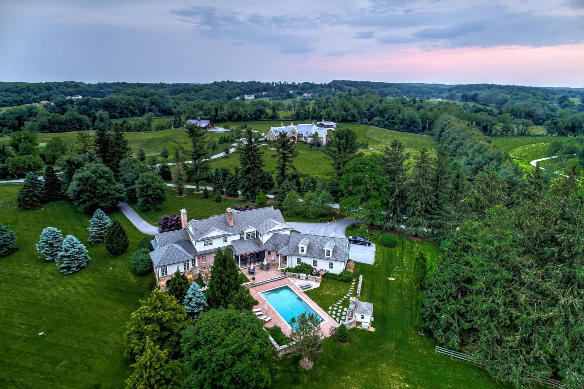
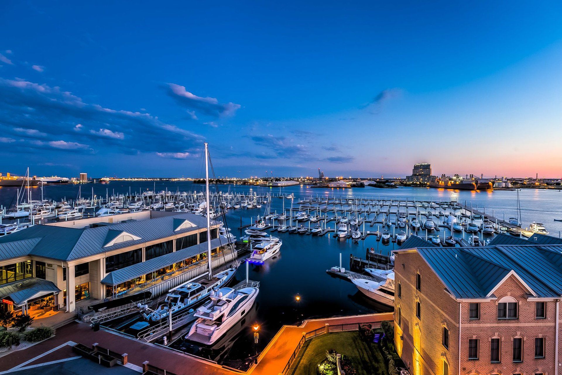
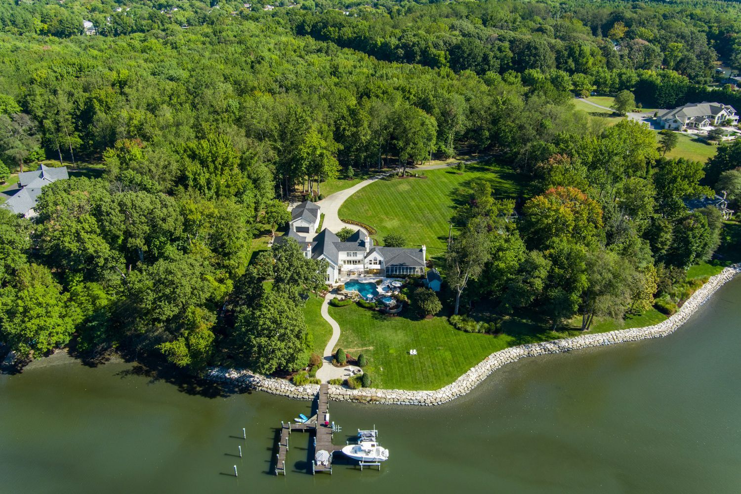
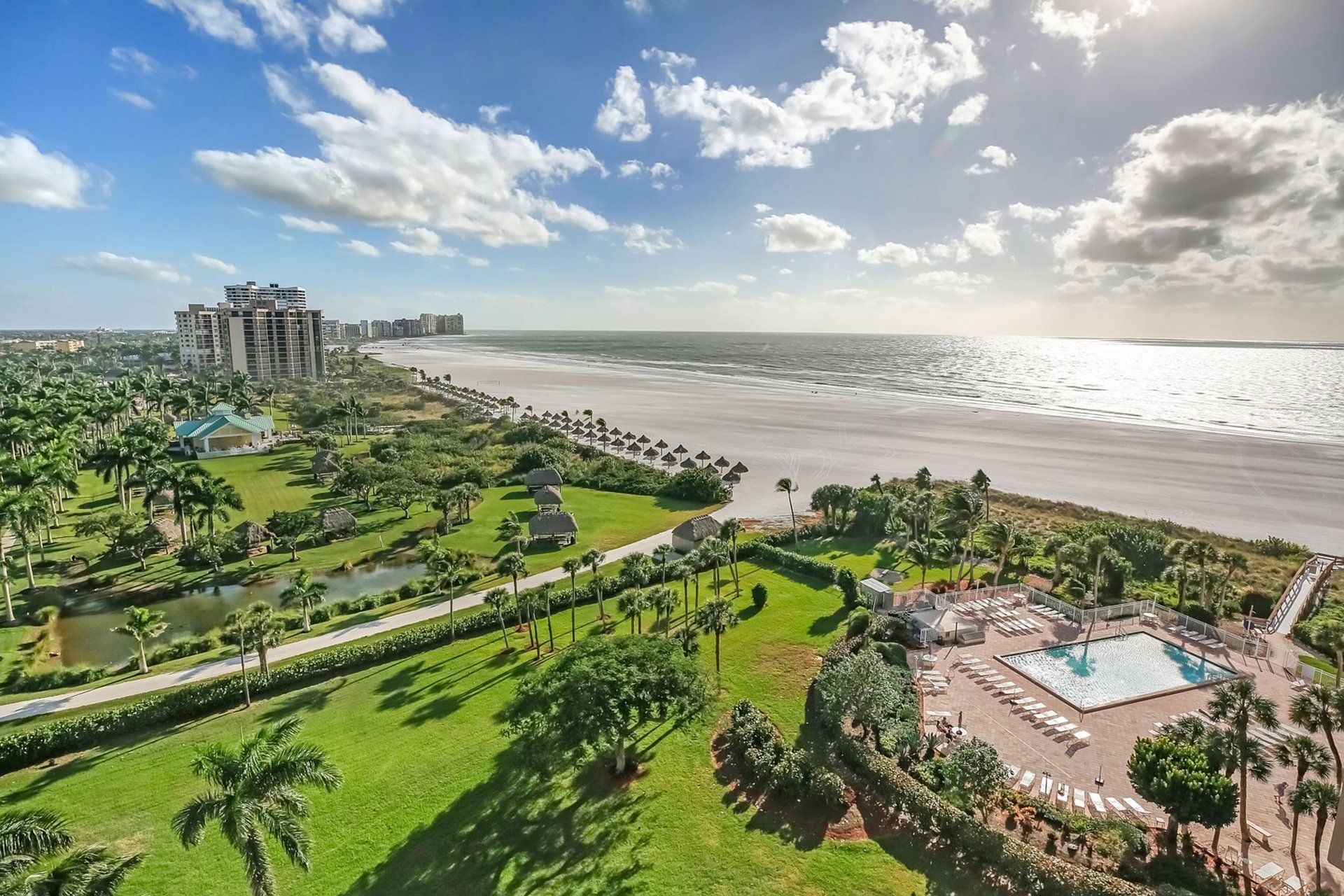
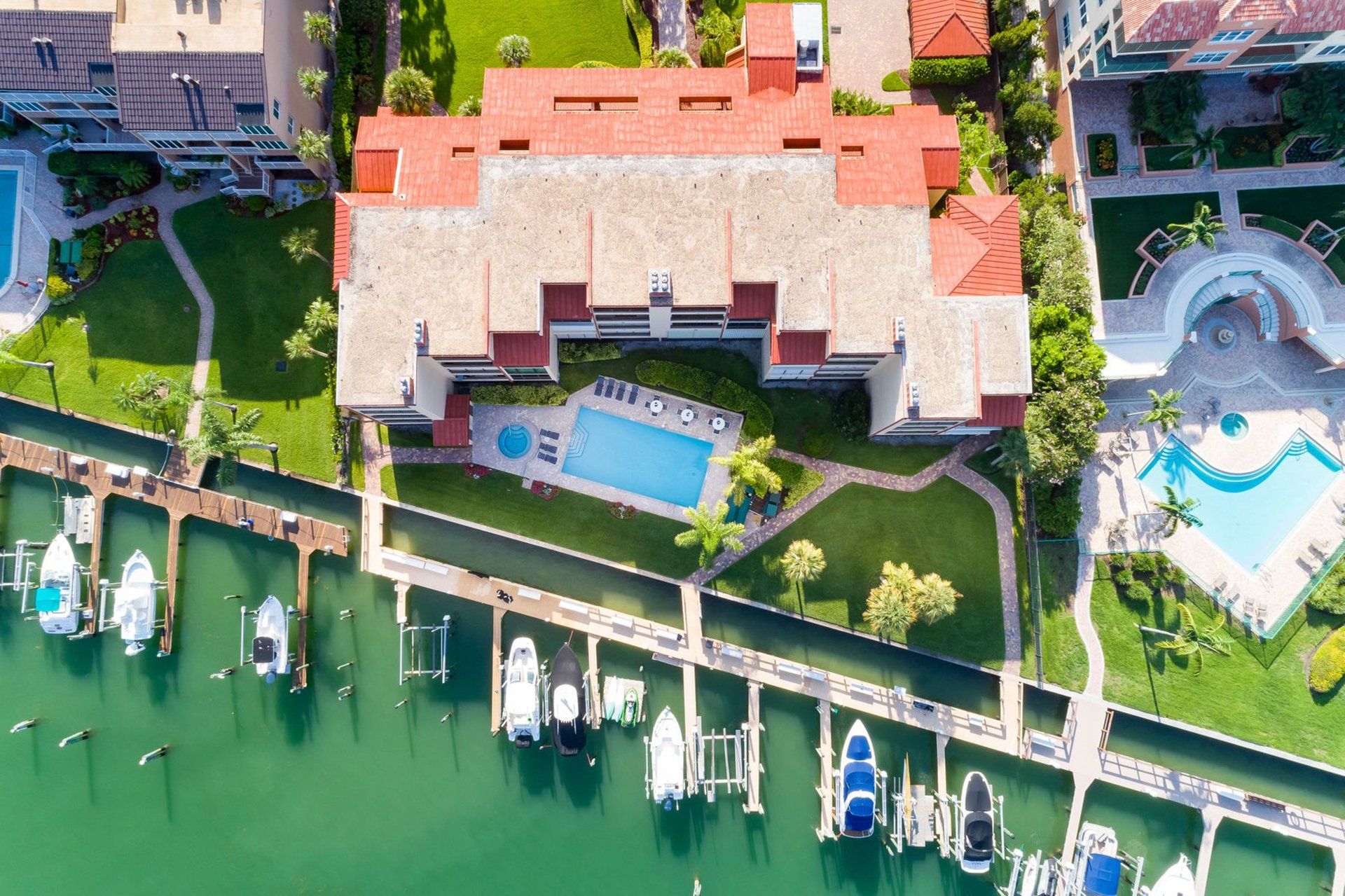
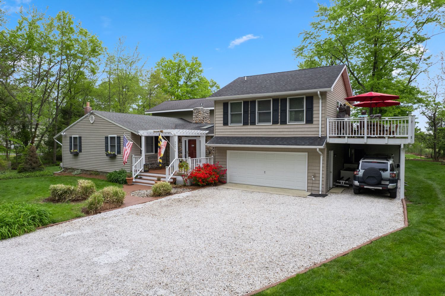
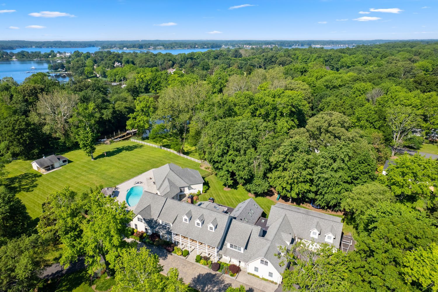
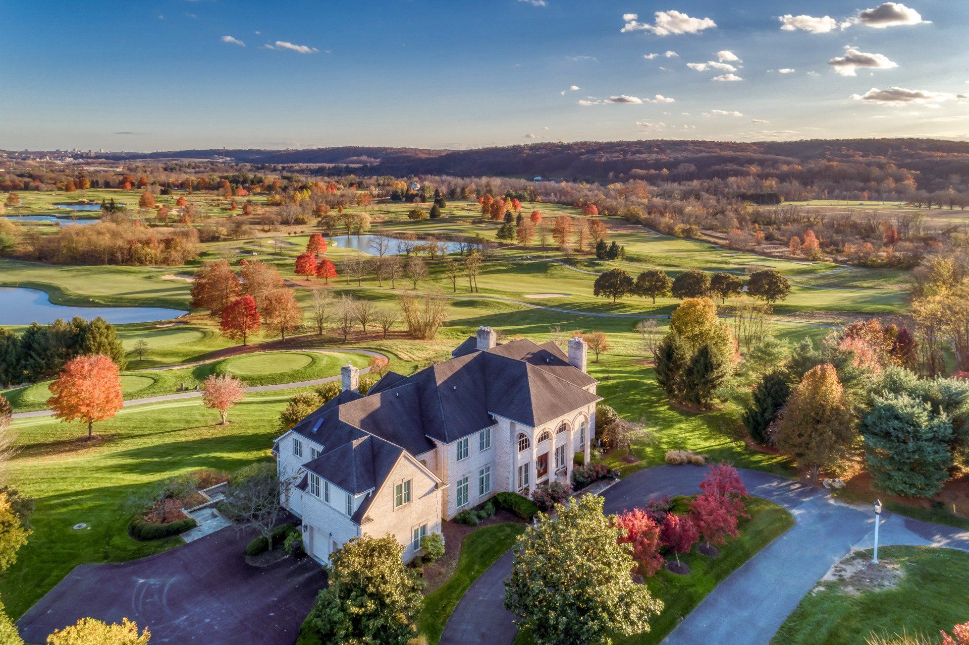
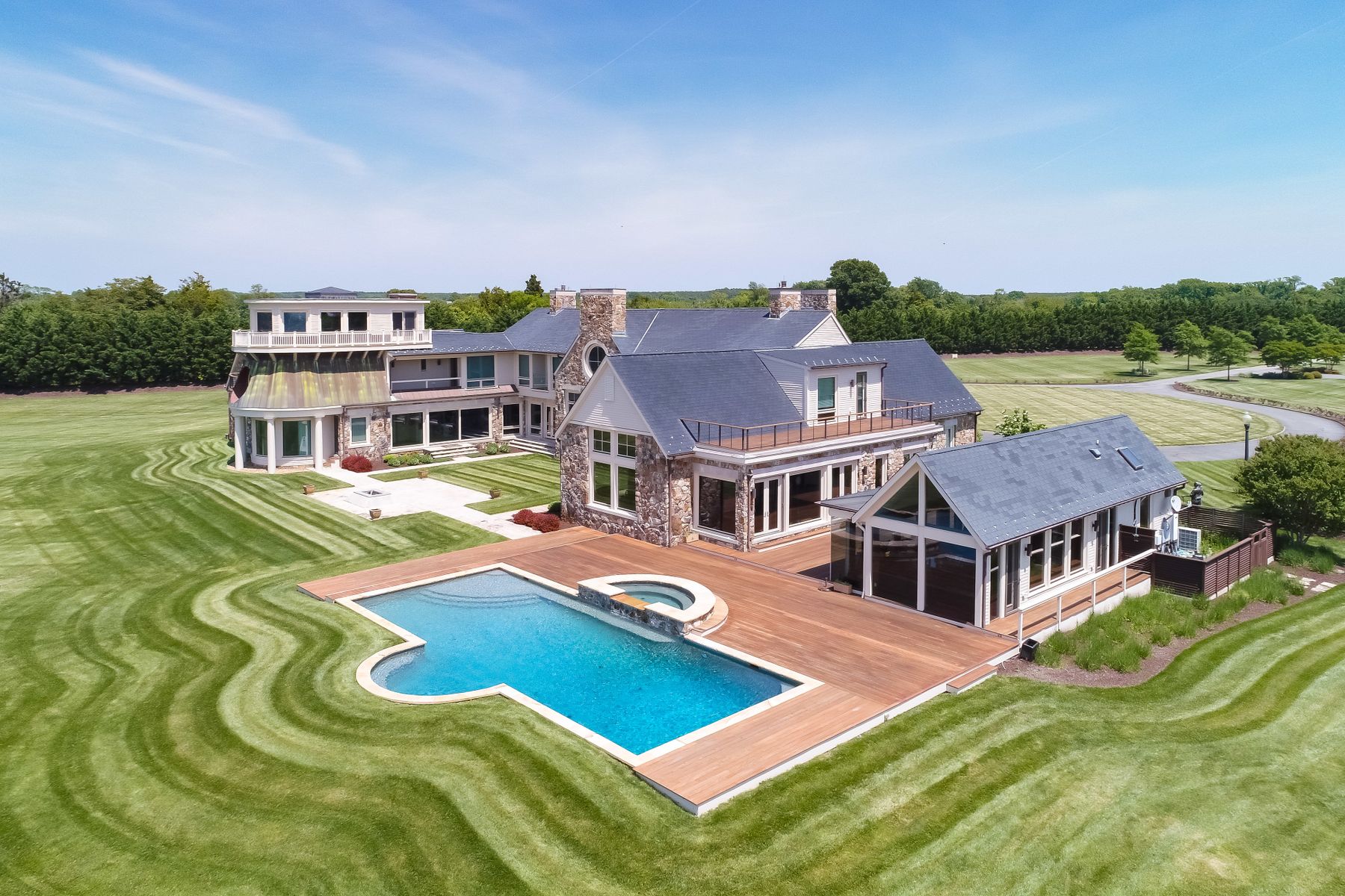
Real Estate Drone Photography

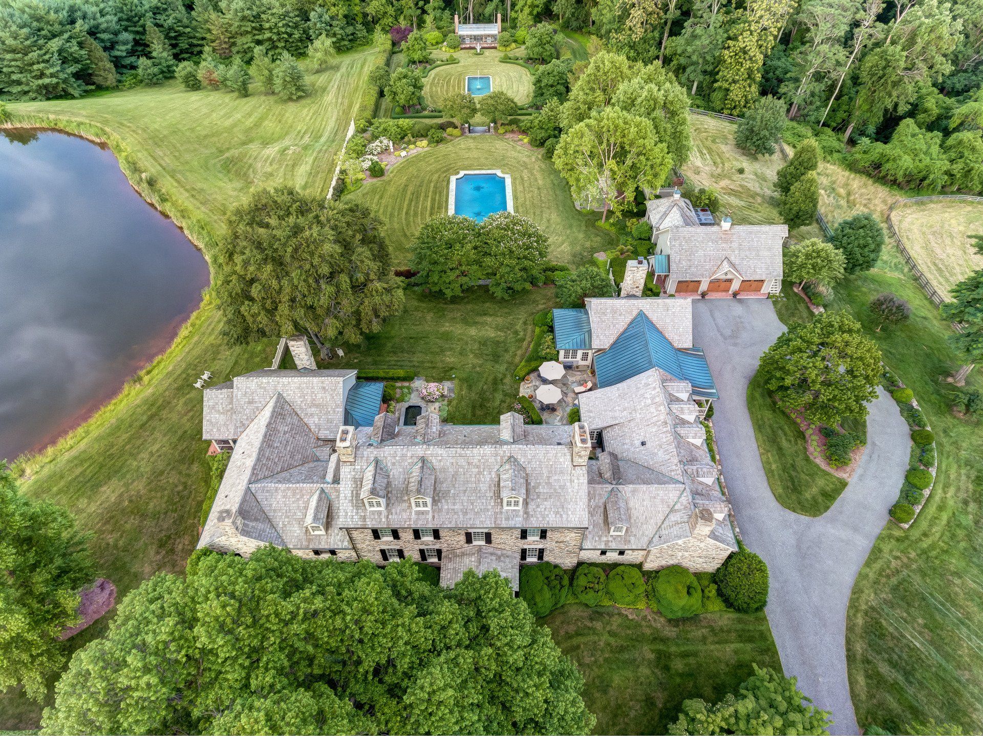
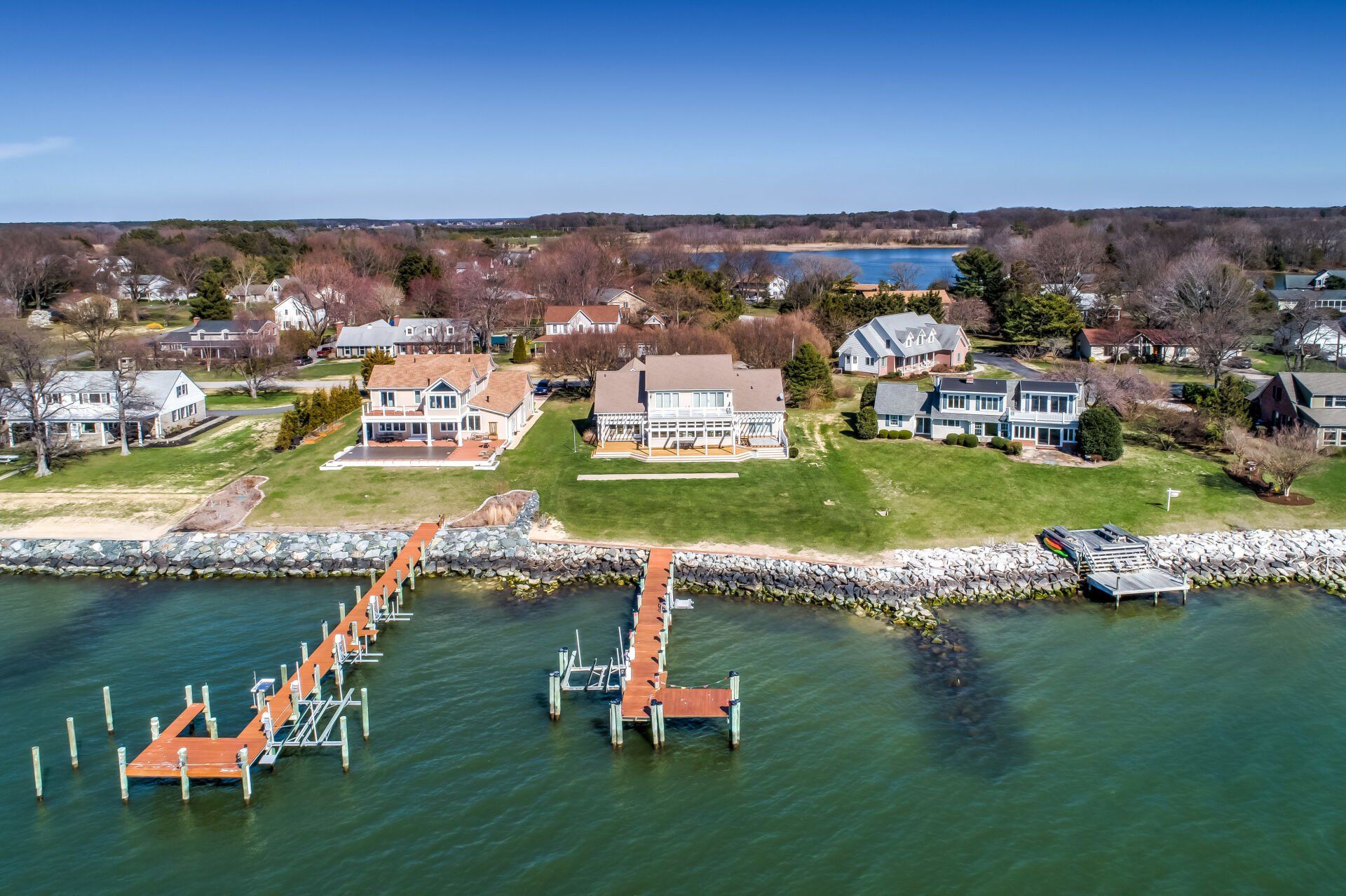
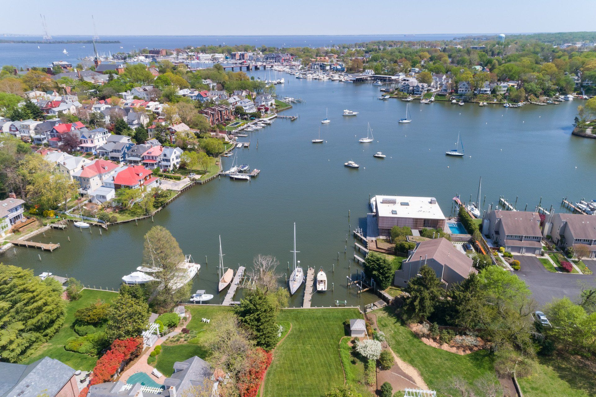
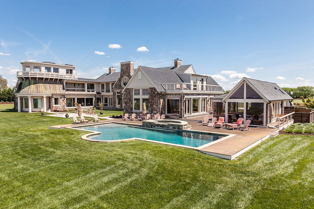
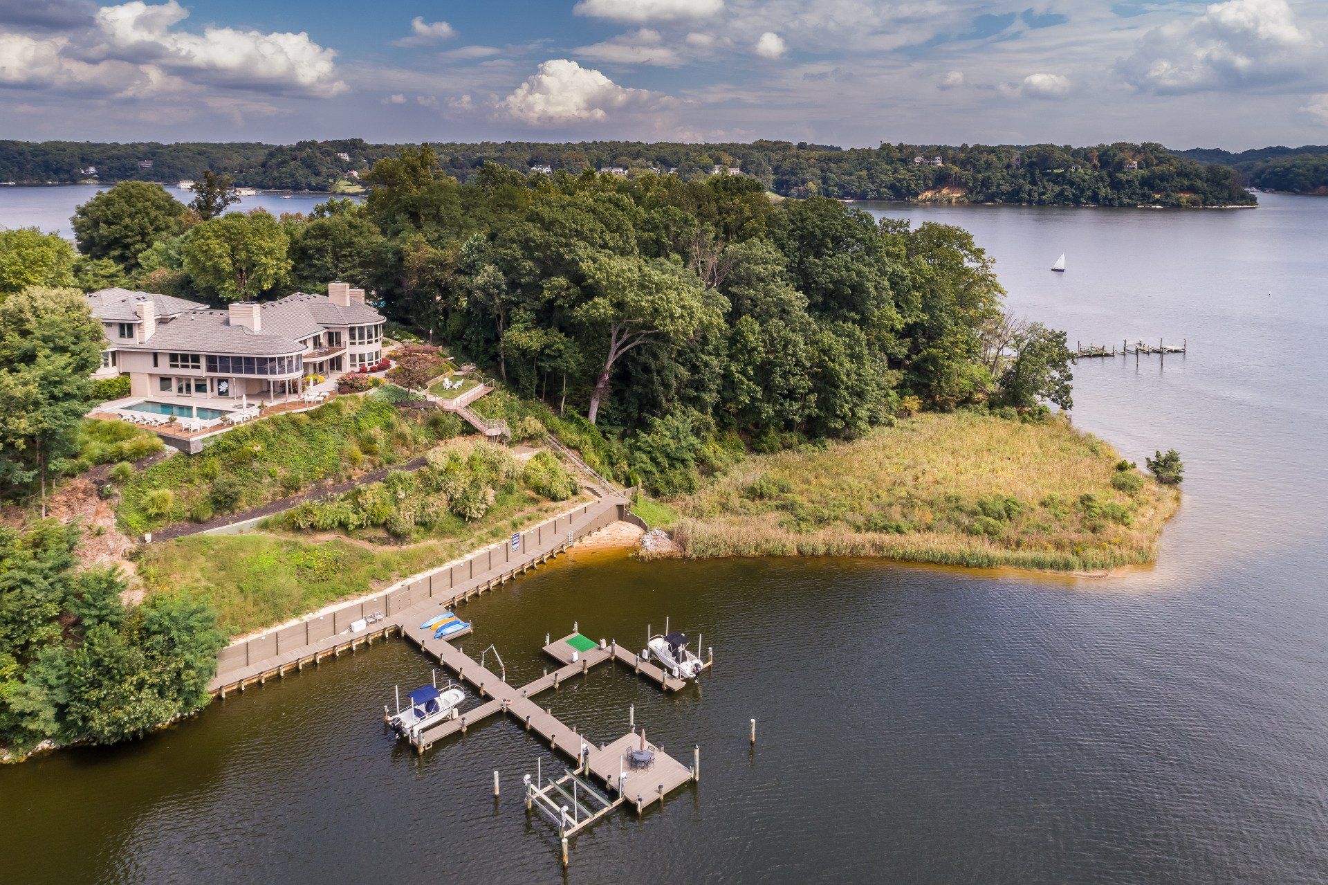
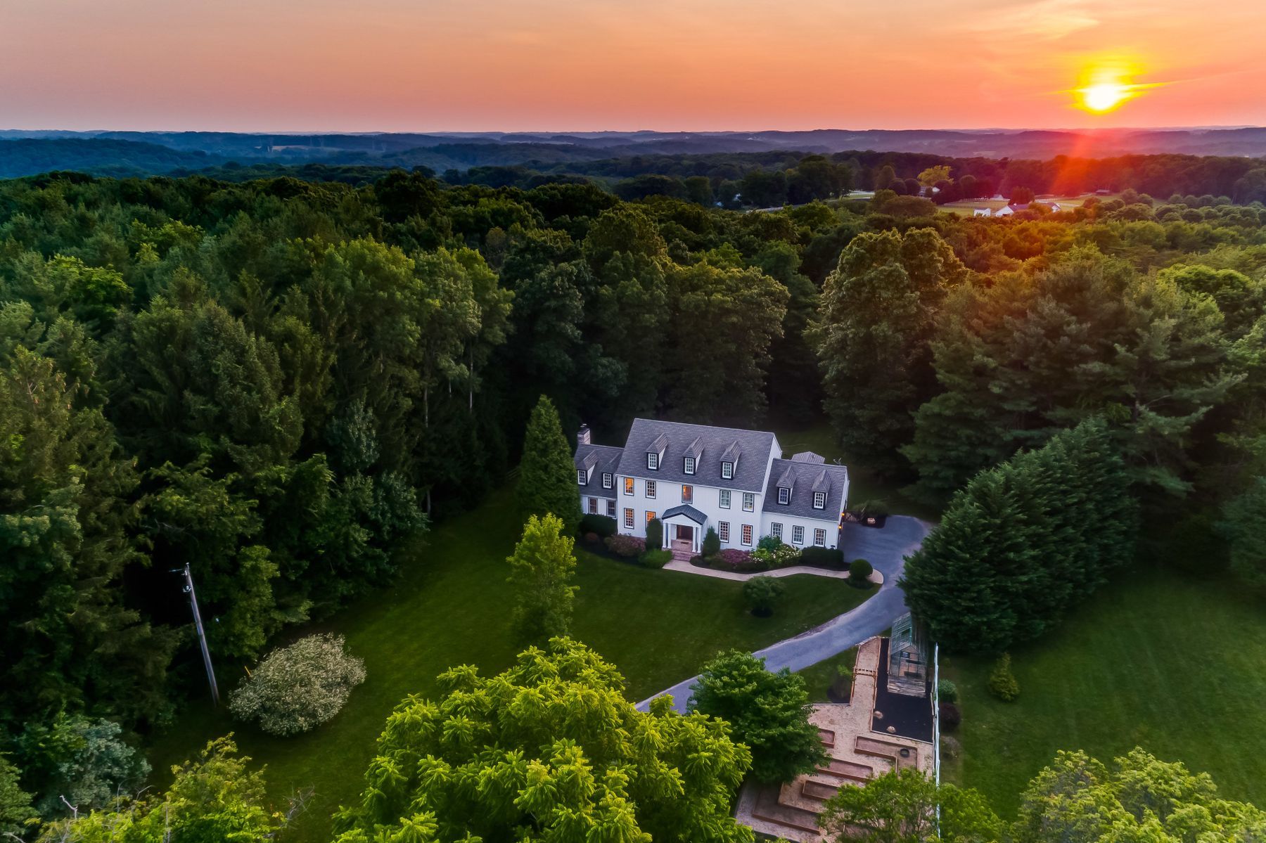
Most drone operators are simply that — operators who occasionally take photos. Our real estate aerial drone images are captured and edited by professional real estate photographers to show the very best of every property. There are several options to suit the needs of each unique property. Drone photography is the most popular request — showing off the property in the daytime or at twilight. Drone video can be captured as an optional add-on to your package.
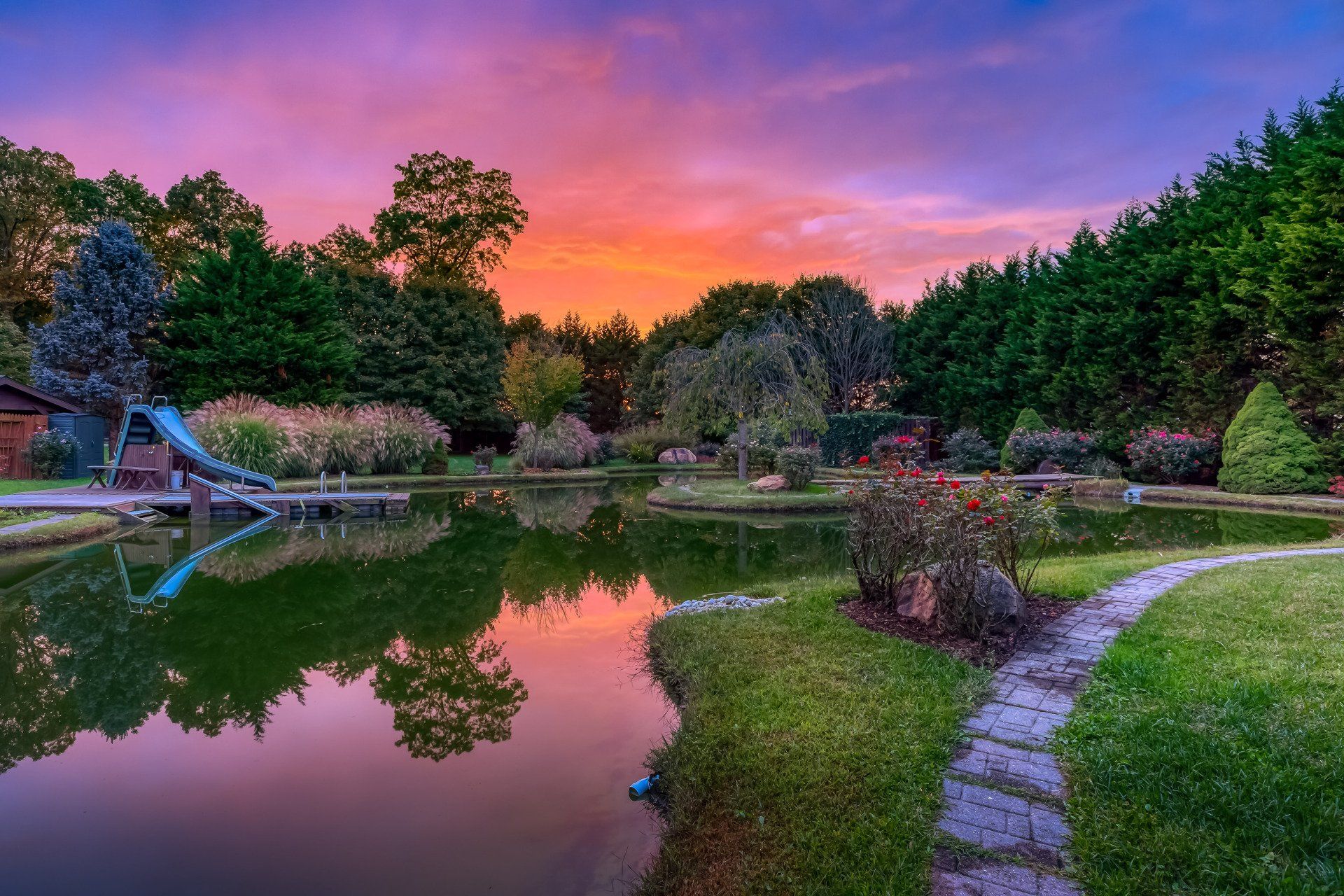
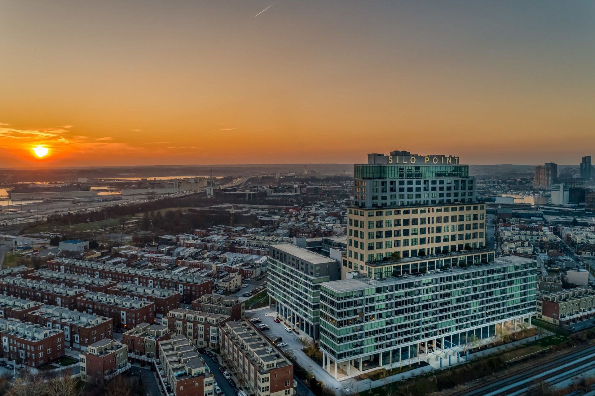
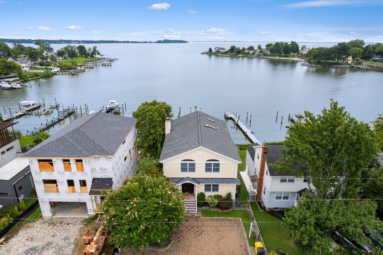
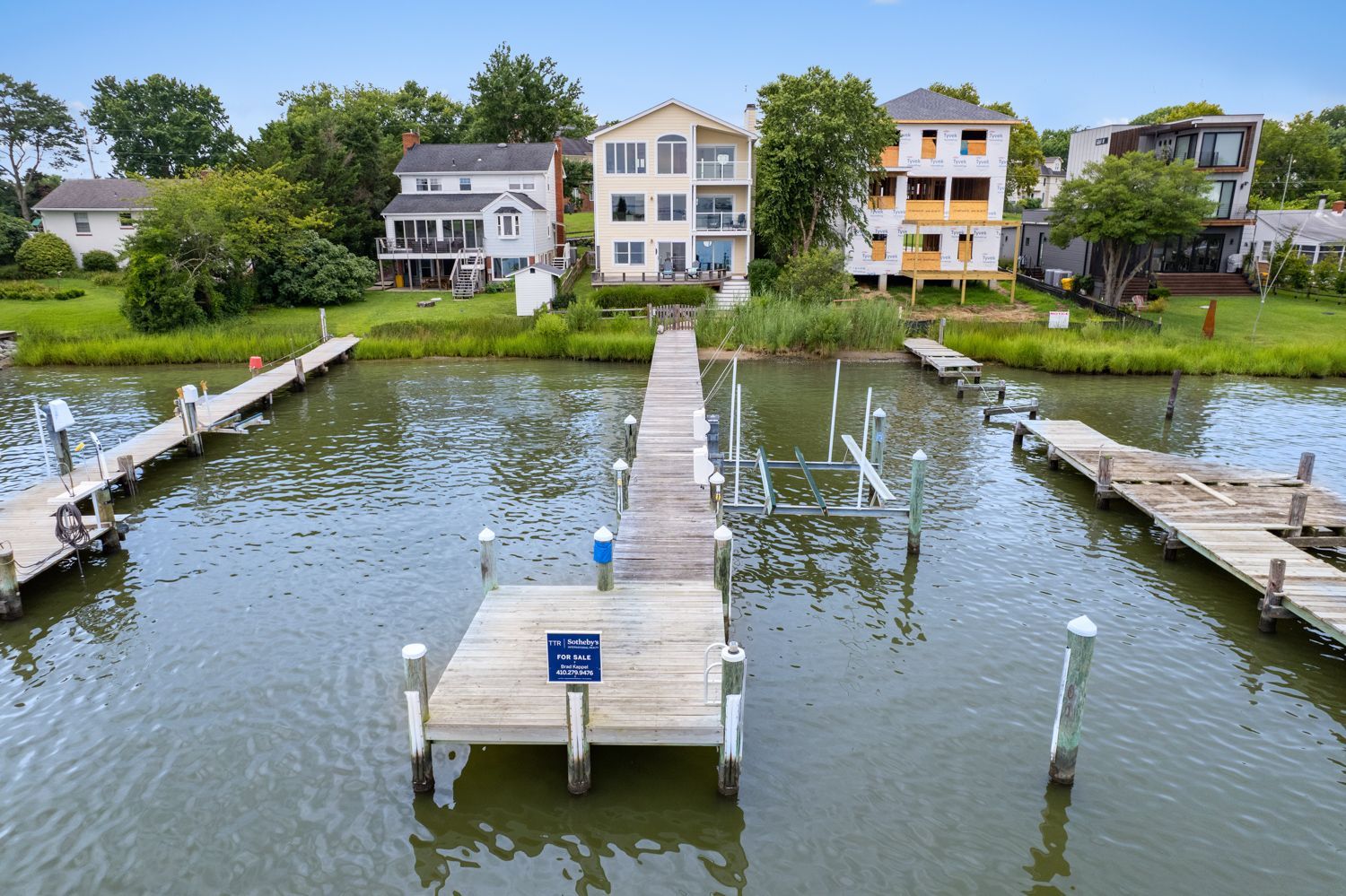

Drone videography 
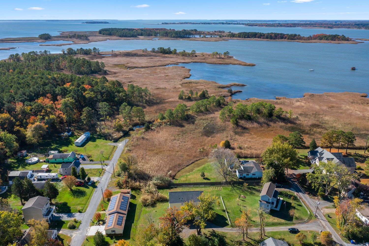
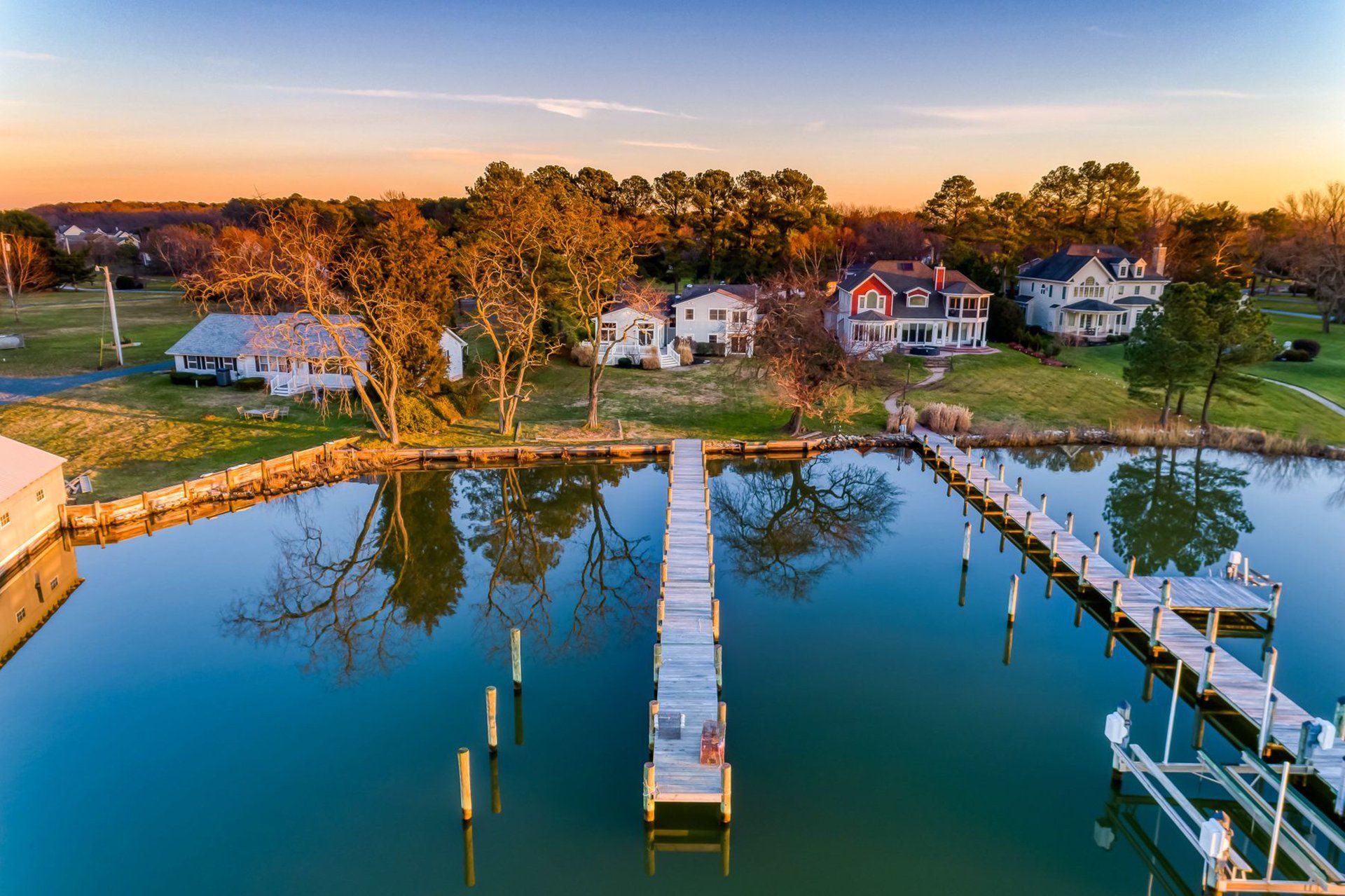
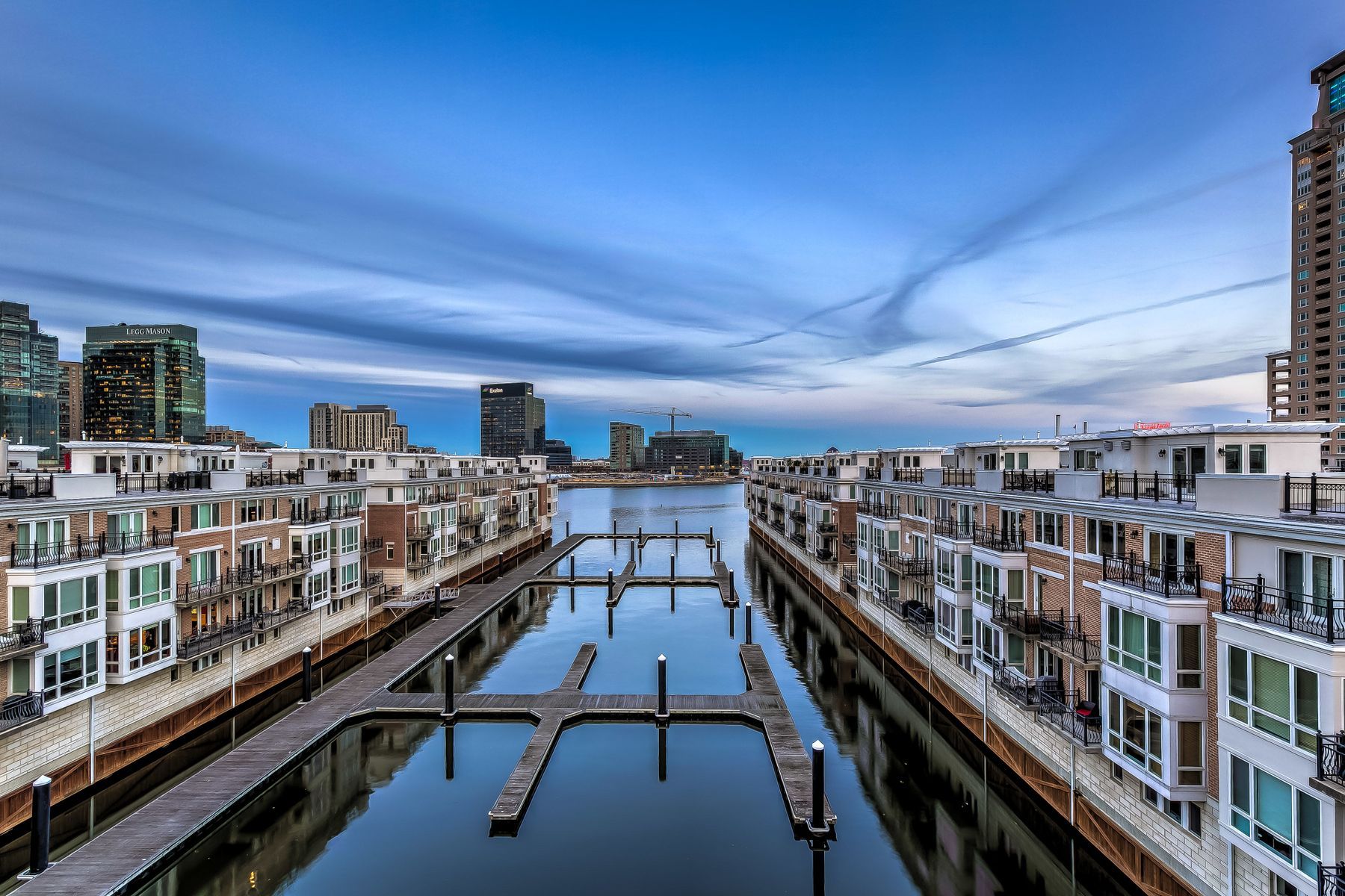
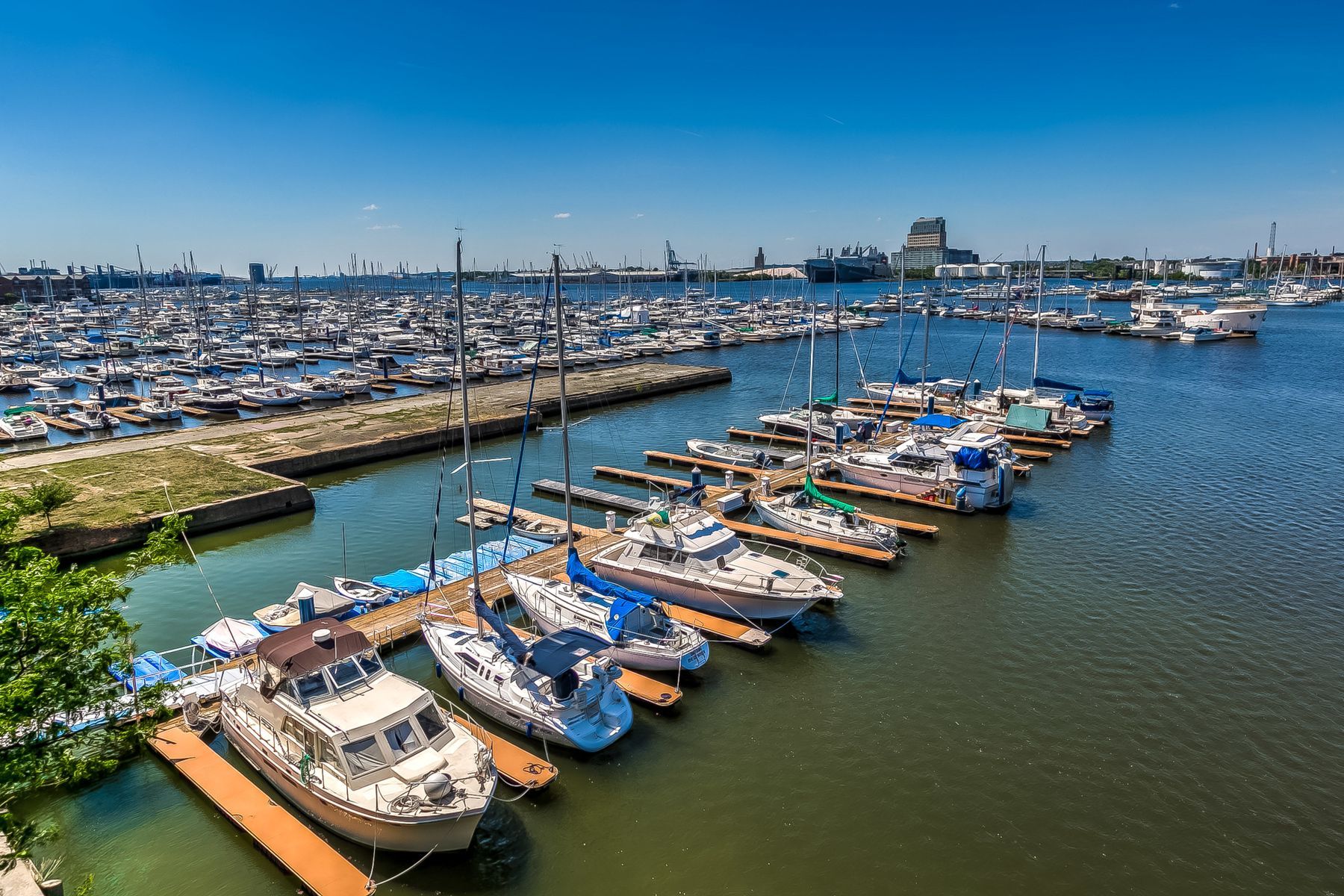
provides viewers with a comprehensive view of the proximity to neighboring properties and amenities in an alternative manner than images alone. Hometrack’s exclusive twilight drone photography is a sunset shoot in the sky! For serious visual impact, twilight drone photography is a surefire way to grab attention.

Schedule

Drone photos are an ideal marketing solution for properties with features like:

Expansive Land / Farm

Pools

  • Slide title

    Write your caption here
    Button
  • Slide title

    Write your caption here
    Button
  • Slide title

    Write your caption here
    Button
  • Slide title

    Write your caption here
    Button

Proximity to Water

  • Slide title

    Write your caption here
    Button
  • Slide title

    Write your caption here
    Button
  • Slide title

    Write your caption here
    Button
  • Slide title

    Write your caption here
    Button
  • Slide title

    Write your caption here
    Button

City Views

  • Slide title

    Write your caption here
    Button
  • Slide title

    Write your caption here
    Button

SHOOT | PRINT | SOLD

Real Estate Drone Packages Include

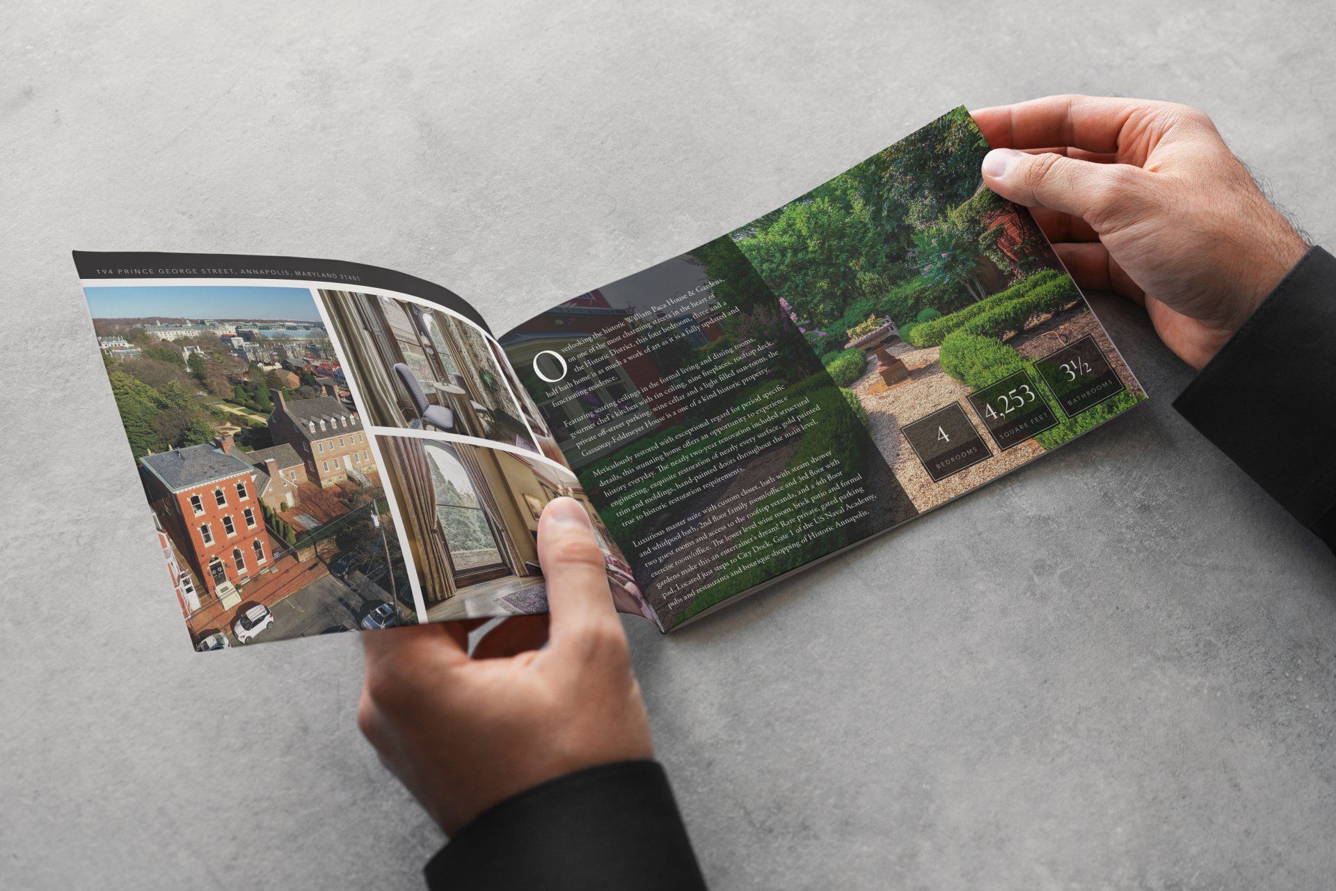
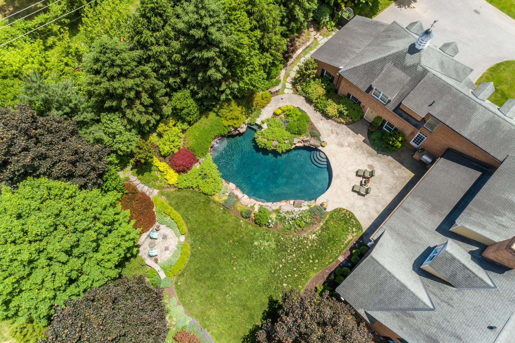
15 or More High Resolution Photos

Fifteen or more beautiful, high resolution professionally edited photos are provided. Includes angles from all around the property and at many different altitudes.

Next Business Day
Delivery

Edited photos from your drone shoot are loaded to your client portal by the next day before 5pm EST. Even on the weekends!

100% Satisfaction
Guarantee

We'll always go above and beyond to ensure your satisfaction with our property marketing services, and we guarantee you'll be happy with our photos no matter what, or we’ll reshoot your property. If you're not happy with our reshoot, we'll refund your money, no questions asked. 

Free MLS Connected
Single Property Gallery

Hometrack includes a BrightMLS connected  single  property  gallery with every listing shoot that you can use to efficiently and effectively market your space.

Why Use Aerial Drone Photography?

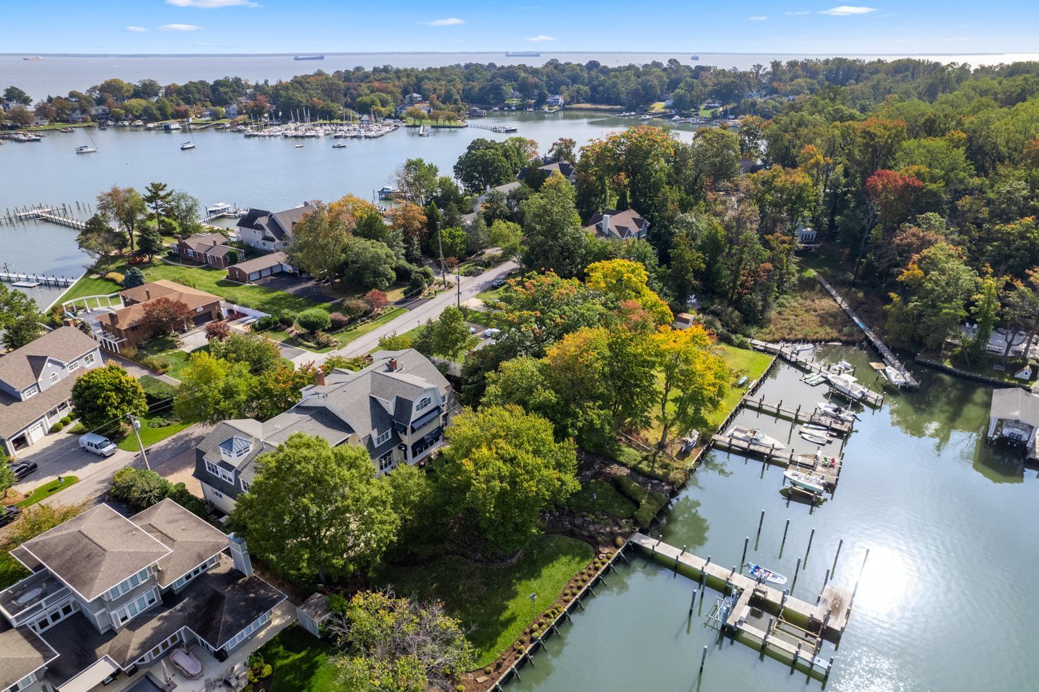
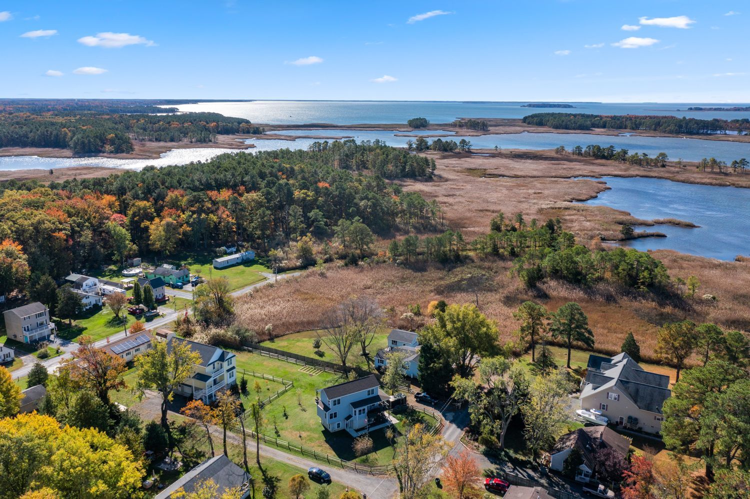
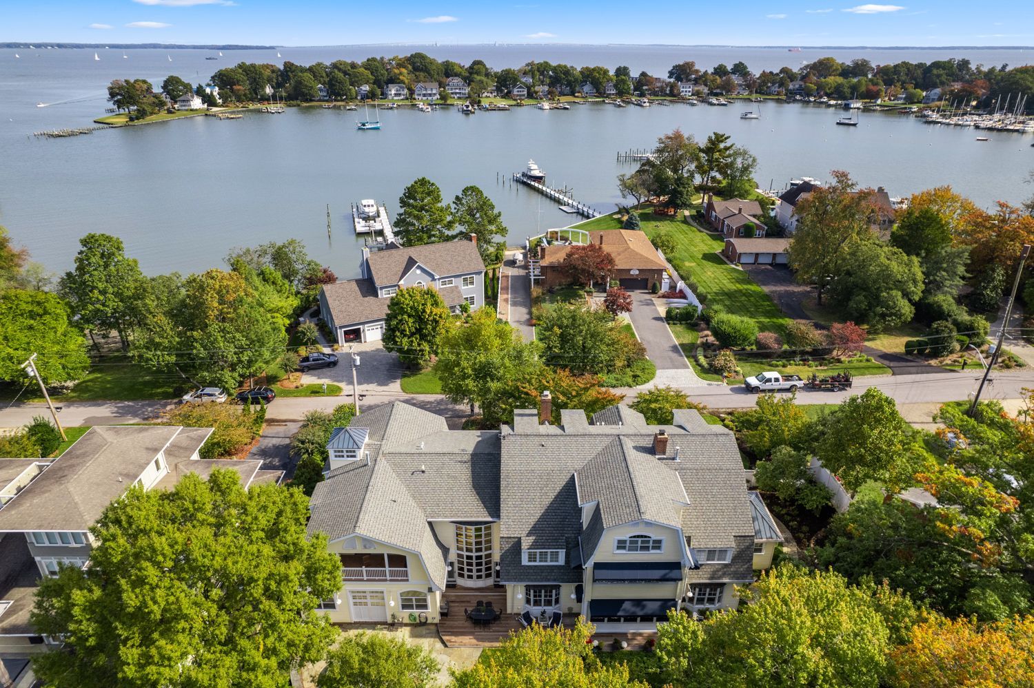
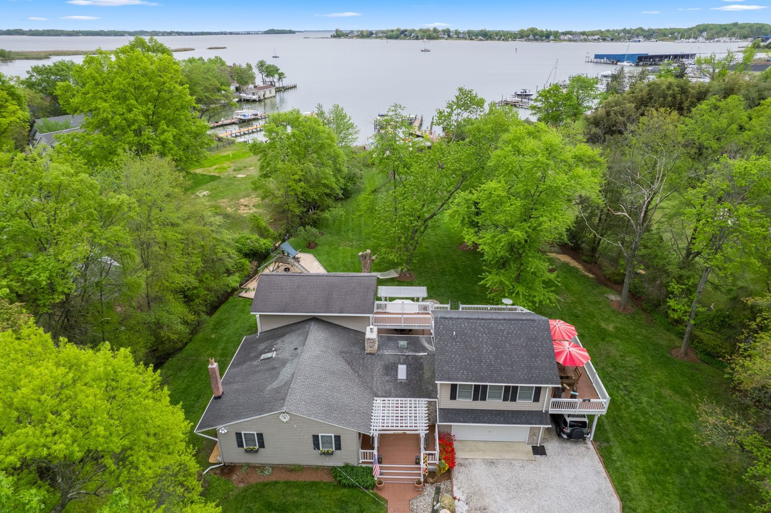
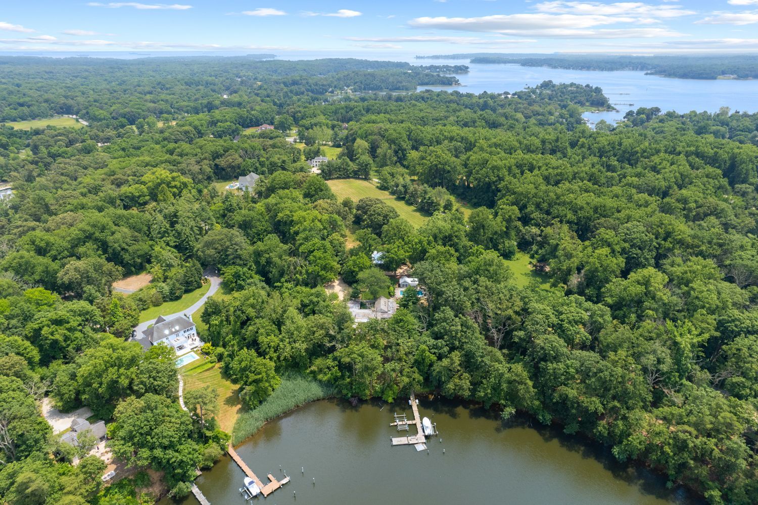
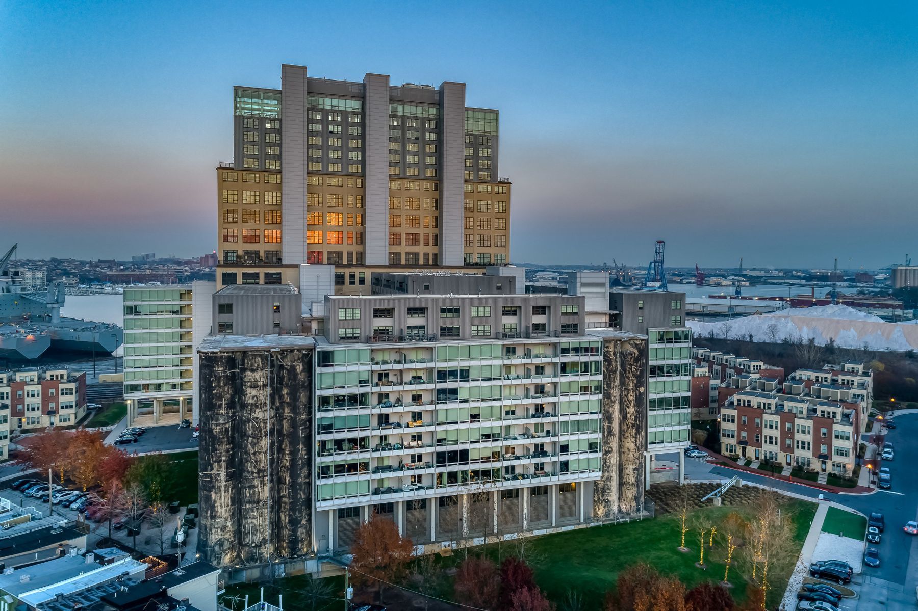
There are many advantages to using aerial drone photography for your listing. Drone photography allows you to capture videos and still photos that you simply wouldn’t be able to achieve any other way. Having an “eye in the sky” will help offer a much more thorough presentation of your listing to potential buyers by showing not only the external characteristics and features of the home itself, but also the surrounding land. Through this new and exciting form of photography for real estate, you can also provide aerial views of the entire neighborhood, to help potential buyers get a feel for the home’s proximity to nearby amenities.


The use of these “flying cameras” has taken real estate video marketing to an entirely new level. With the help of professional drone photography, you can create dramatic, sweeping views of your listing that will capture the imagination of potential buyers. Using elevated real estate photography, you can present previously unattainable views and angles of your properties that can highlight their unique features, as well as their layouts and positioning within the context of the surrounding areas.


In many ways, today’s real estate market is more competitive than ever. The advent of digital technology has essentially eliminated many of the competitive advantages that used to differentiate real estate firms from one another. Nowadays, most buyers begin their property search online through search engines, social media, reviews, and more, which means they are going to encounter your listing digitally first before they ever set foot inside your property.


Stay ahead of your competition with aerial drone photography. If you want your listing to stand out from the pack, consider using our professional drone photographers, as it is one of the most powerful marketing weapons available to help you differentiate your property listings and maintain your competitive edge.

Hometrack provides a complimentary MLS connected and customizable Single Property Gallery with every HDR, Drone, Matterport, and Video shoot

Learn more about features of our single  property  gallery in this video. SEO enhanced for greater visibility for your brand and your listings. Our gallery includes:

  • MLS connected gallery
  • Statistics page that you can email to your seller
  • Customized colors to match your brand
  • Embed the gallery on your website
  • Sharable on social media
  • AI generated SEO-optimized and ADA-compliant captions for property photos in real-time

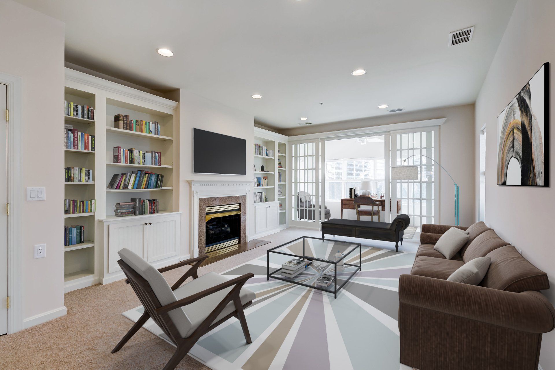
Hometrack captures rich media content for all your property marketing

FAQs

Got a question? We’re here to help.
  • What is real estate aerial drone photography?

    Real estate aerial drone photography is the process of capturing images and videos of properties from the air using a drone. This type of photography provides a unique perspective and allows for capturing angles and views that are not possible with traditional ground-level photography.

  • What equipment is used for aerial drone photography?

    Aerial drone photographers typically use high-quality drones equipped with cameras, such as the DJI Phantom or Mavic series. The camera should have a minimum of 12 megapixels and 4K video capabilities. In addition, photographers may use stabilizing gimbals, extra batteries, and other accessories to ensure smooth and stable flights.

  • What are the benefits of using aerial drone photography in real estate?

    Aerial drone photography provides a unique perspective that sets listings apart from others. It allows for capturing angles and views that are not possible with traditional ground-level photography, provides a comprehensive view of the proximity to neighboring properties and amenities, and can help differentiate a property listing and maintain a competitive edge.


    If a property has a pool or extensive land that is in the back of the property. Drone photos allow you to capture as much of that as possible in the main MLS photo. The more features of the property you can show and capture in that photo, the better chance you have of capturing someone's attention when they are scrolling online.

  • What makes Hometrack's aerial drone photography different from others?

    Hometrack's aerial drone images are captured and edited by professional real estate photographers to show the very best of every property. Hometrack offers several options to suit the needs of each unique property, including drone photography, drone videography, and exclusive twilight drone photography.

  • Are Hometrack's photographers experienced in aerial drone photography?

    Yes, Hometrack's photographers have experience flying drones and capturing aerial images for real estate properties. They are skilled in capturing high-quality images from the air and are familiar with the regulations and safety considerations when flying drones.

  • How is the editing process performed by Hometrack's photographers?

    Hometrack's photographers process the raw images captured by the drone camera to remove any distortions, correct color balance, and adjust exposure. To create panoramic views, multiple images may be stitched together to create one seamless image. The final images are then edited to ensure they meet the standards of quality and presentation desired by the client, including adjusting brightness and contrast, adding branding, and removing any distracting elements.

  • What is the turnaround time from the time of the shoot to delivery?

    Hometrack guarantees that your photos will be uploaded to your client portal online by 5:00pm EST the day after the property was photographed. Weekends too! A notification email will be sent once your photos (and any other assets) are ready to be viewed.

  • What options are there for rush delivery?

    Need rush? No problem! We offer same day rush for a 30% upcharge of the total shoot. Next day rush (before 9am) is a 15% upcharge of the total shoot.

  • Do I need to be present at the time of the shoot?

    Being onsite would allow you offer input to the  photographer for any specific angles or features you might have in mind to include. Otherwise we’ll use our  professional judgment and will take  photos that best market the space. You can also have our client services team relay your request to our photographers.

  • What happens if I need to cancel my shoot?

    To maximize efficiency of our shooters schedules, Hometrack considers the following day's shoots "locked" unless a cancellation comes in before 5pm EST the day prior (including weekends). We understand that life happens and sometimes a cancellation isn't known by that time. Therefore, we keep our cancellation fee as low as possible. Contact our client care team at admin@hometrack.net for more information.

  • Can I change my order onsite with the photographer?

    Certain items may or may not be added on the day of the shoot or when the photographer is onsite because we schedules a specific amount of time onsite based on products ordered and equipment needed. If the photographer has time based upon the daily schedule, they will most certainly accommodate your request. 

  • What if I am not happy with the photos?

    100% Satisfaction Guarantee: At Hometrack, we are committed to delivering exceptional quality for all of our photos. If for any reason you aren't completely satisfied with the final result, we'll work with you until you are. We stand behind our work and guarantee your complete satisfaction.

  • What are the benefits of using Hometrack's aerial drone photography?

    Hometrack's aerial drone photography provides a unique perspective that sets listings apart from others. It allows for capturing angles and views that are not possible with traditional ground-level photography, provides a comprehensive view of the proximity to neighboring properties and amenities, and can help differentiate a property listing and maintain a competitive edge.

  • Are there any safety, privacy, and regulatory considerations when using Hometrack's aerial drone photography?

    Yes, there are safety, privacy, and regulatory considerations when using Hometrack's aerial drone photography. Hometrack's photographers are familiar with the regulations and safety considerations when flying drones, and ensure that they are following all applicable laws and guidelines. Hometrack also considers privacy concerns and obtains consent from any individuals who may be captured in the images.

Share by: